The Seven Hills Table
Duke Energy Convention Center
Inspired by the unique geography of Cincinnati, this table reimagines the seven hills of cincinnati as jewels. Each incased in a glass covered pocket milled directly into the table itself. The edge of the table is cut to mimic the meandering flow of the Ohio River as it runs past the southern boarder of our fair city. Materials include sustionably harvested regional solid ash, water jet cut tempered glass, and powdercoated steel.
This project was made possible by ArtWorks, the City of Cincinnati, and the Duke Energy Convention Center.
Satellite
Imagery
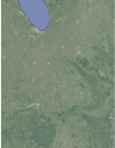
Satellite images are used to identify the geographic area for conversion. In this example we are looking at the Mid-East United States From Lake Michigan to Central KY.
Shuttle Radar Topography
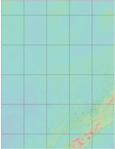
After the geographic area is identified raw topographic data is acquired from the Shuttle Radar Topography Mission (SRTM).
Greyscale
Analysis

Data from SRTM is then converted to a greyscale image file. White represents the highest points, black the lowest.
Displacement Surfaces
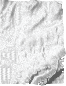
3D software is then used to create a high polygon displacement surface.
Low-Poly
Filtration

A low-poly filtration is then applied to the 3D surfaces. This serves to simply the geometry for higher contrast, stylized surfaces better suited to CNC machining.